WorldPop

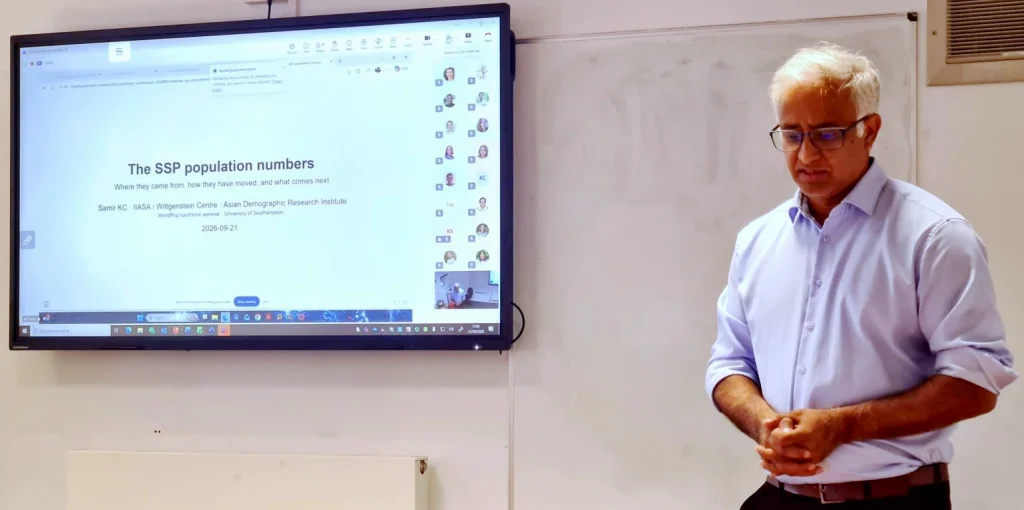
Photo of Professor Samir KC presenting at WorldPop

Building the next generation of population futures: Samir KC visits WorldPop

How can we move beyond national population projections to understand how populations may change in individual regions, cities and communities? That question was at the heart of a recent visit to WorldPop by Samir KC, one of the world’s leading demographers, professor at the Asian Demographic Research Institute (ADRI), Shanghai University, and a Senior Research […]

Building the next generation of population futures: Samir KC visits WorldPop Read More »

Photo of someone sleeping under mosquito net.

How human expertise and AI can support vector-borne disease control

As climate change, urban growth and human movement reshape the world around us, the diseases carried by mosquitoes are changing too. Malaria, dengue and other mosquito-borne illnesses are appearing in new places, putting more communities at risk than ever before. A new Perspective paper in Environmental Change and Disease Dynamics and co-authored by WorldPop visitor

How human expertise and AI can support vector-borne disease control Read More »

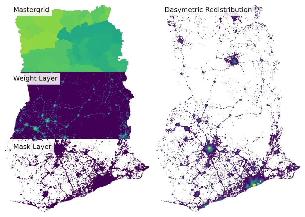
Map showing output from pyDasymetric tool

Turning Population Counts into High-Resolution Maps with pyDasymetric

Creating accurate population maps often starts with a challenge: population data are typically reported for administrative areas, but decisions need to be made at a much finer scale. To help bridge that gap, we have released pyDasymetric, a free, open-source Python package that makes it easier to redistribute population counts into high-resolution gridded population datasets

Turning Population Counts into High-Resolution Maps with pyDasymetric Read More »

graphic image of speech bubbles with text: "Thanks for your feedback"

You told us what you need. We’re acting on it.

More than 420 people from around the world have helped shape the future of WorldPop.  Researchers, government analysts, public health specialists, humanitarian practitioners and technical experts responded to our recent user requirements survey, sharing how they use WorldPop data, what works well and where they see opportunities for improvement.  What they told us was both

You told us what you need. We’re acting on it. Read More »

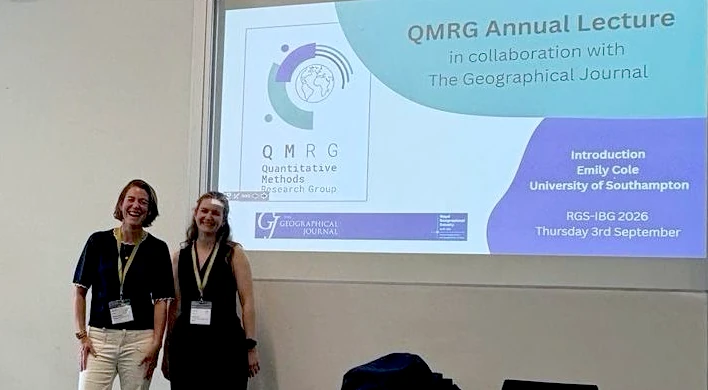
Photo of Dr Jessica Espey with Emily Cole at the QRMG Annual Lecture, 2026.

From local knowledge to global decisions: advancing inclusive data science

How do we make sure data reflects the people and places it is meant to represent? And how can cities make better decisions in an increasingly complex world? These were some of the questions explored by Dr Jessica Espey, Deputy Director (Research) at WorldPop, during recent engagements at the Royal Geographical Society Annual Conference in

From local knowledge to global decisions: advancing inclusive data science Read More »

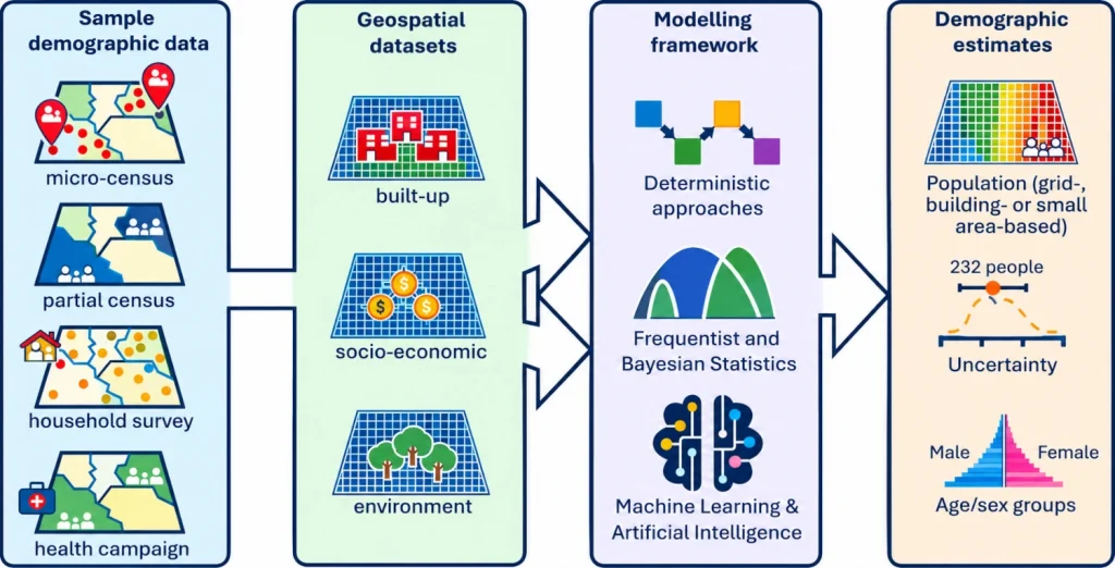
Graphic showing components of the bottom–up approach to small area population estimation.

New Ways to Count Populations When the Census Falls Short

Reliable population data is one of the foundations of effective decision-making. Governments use it to plan schools, hospitals and infrastructure. Humanitarian agencies rely on it to deliver aid. Health organisations need it to estimate how many vaccines, medicines and health workers are required in different communities. Yet for many countries, obtaining accurate and up-to-date population

New Ways to Count Populations When the Census Falls Short Read More »

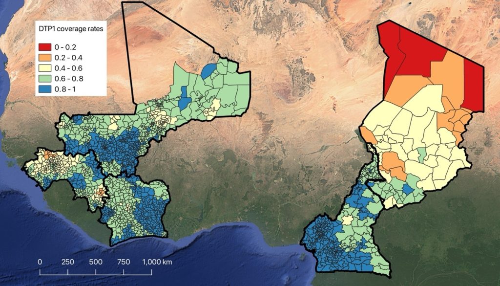
Regional map of West and Central Africa showing results from the Reach the Unreached project

Despite Progress Nearly 1 Million Children in West Africa Still Miss Out on Life-Saving Vaccines 

By Attila N Lazar and Tim O’Riordan While global immunisation efforts have seen significant progress, our new high-resolution, digital population and vaccination coverage maps produced for the UNICEF-funded Reach the Unreached project indicate that nearly one million children in five West and Central African countries remain unreached by vaccination services. Despite increased access in many

Despite Progress Nearly 1 Million Children in West Africa Still Miss Out on Life-Saving Vaccines  Read More »

New Method Developed for High-Resolution Mapping of Refugee Populations

A new study published in the Journal of International Humanitarian Action demonstrates how combining humanitarian registration data with satellite imagery and population maps can produce detailed, high-resolution maps of refugee populations – providing crucial information for humanitarian response and resource allocation. The research, led by WorldPop researchers in collaboration with UNHCR, developed and tested a

New Method Developed for High-Resolution Mapping of Refugee Populations Read More »

New Research Maps Vaccination Coverage Gaps in Nigeria to Support Measles Control Efforts

A new study led by WorldPop researchers has produced detailed maps showing where children missed out on measles vaccination during Nigeria’s 2021 vaccination campaign, providing crucial insights to help health officials reach underserved communities. The research, published in the journal Vaccines, analyzed data from 13 Nigerian states to identify areas where children remained unvaccinated both

New Research Maps Vaccination Coverage Gaps in Nigeria to Support Measles Control Efforts Read More »

New Tool Maps Progress in Child and Maternal Health Across Low- and Middle-Income Countries

WorldPop has launched an interactive web application that enables users to explore and visualize child and maternal health indicators at subnational levels across selected low- and middle-income countries (LMICs). The CMH Progress Map provides detailed geographic insights into key health metrics, socio-economic factors, and progress toward Sustainable Development Goals (SDGs). The tool presents multiple indicators

New Tool Maps Progress in Child and Maternal Health Across Low- and Middle-Income Countries Read More »