
Knowing how many people live in a place – and where they live – matters. Local population data underpins everyday decisions, from planning schools and health services to organising elections and responding to emergencies. Yet in many parts of the world, especially in resource-limited settings, this information is missing, outdated, or incomplete.
 Traditional population and housing censuses are expensive and often carried out only once every ten years. By the time results are available, rapid population growth, migration, and urban change can mean the data is already out of date. Some communities may be missed entirely, and local boundary information can be unclear or inconsistent. When this happens, services are unevenly distributed, resources are wasted, and people are excluded from decisions that affect their lives.
WorldPop is an interdisciplinary research group based at the University of Southampton, bringing together around 40 researchers, data scientists, and specialists. Our work focuses on improving population data at local levels and helping ensure it is used effectively for health, development, and humanitarian action, including tracking progress towards the Sustainable Development Goals (SDGs).
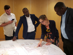
We work closely with governments, UN agencies, and partners to combine information from satellites, surveys, cellphones, and other geospatial sources. By co-developing and applying innovative methods, we help fill critical population data gaps and support the real-world use of these insights.
Our purpose is simple: to help decision-makers use high-quality population data so that everyone, everywhere, is counted in the decisions that shape their future.
Over the past decade, WorldPop’s data and methods have been used around the world to support real decisions that affect millions of lives. Governments, UN agencies, researchers, and even private organisations rely on our population maps to understand where people live and how best to reach them.
WorldPop’s subnational population data is now built into health information systems used by more than 80 ministries of health, covering an estimated 3.2 billion people. It also underpins UN estimates of populations affected by disasters and conflicts, helping humanitarian organisations respond more quickly and effectively when crises strike.
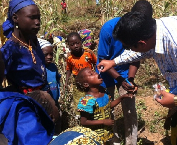 Our population maps play a vital role in public health. They have been used to plan and deliver childhood vaccination campaigns, helping an extra one million children receive life-saving vaccines in Afghanistan, and supporting the elimination of polio in Nigeria – while saving more than $150 million each year in programme costs.
WorldPop data has also supported national decision-making in times of crisis. During the Covid-19 pandemic, our population estimates formed the demographic foundation for models used by multiple governments to guide public health responses. Beyond emergencies, our data has helped countries such as Colombia, South Sudan, and Papua New Guinea develop official population estimates that inform long-term planning and resource allocation.
Together, these examples show how better population data can lead to fairer, more effective decisions – turning numbers on a map into meaningful real-world impact.