New Disease Mapping Identifies COVID-19 Hotspots in Dakar to Guide Public Health Interventions
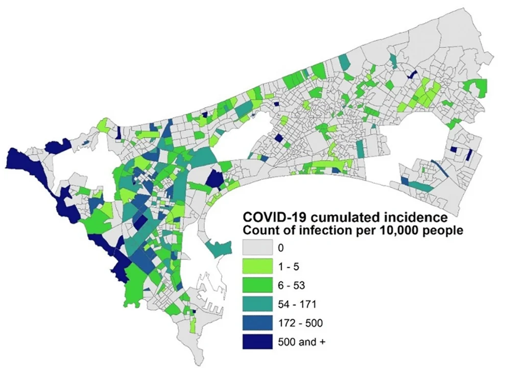
Take Our Survey and Help Shape What Comes Next A new study by an international team of researchers has successfully mapped the neighbourhood-level spread of COVID-19 in Dakar, Senegal, revealing that high-density residential areas in the city’s west face the greatest risk of infection. The research, led by WorldPop Research Fellow, Dr Assane Gadiaga at the University of Southampton […]