open data

Visible infrared satellite loop of Cyclone Ditwah, by SSEC/CIMSS, University of Wisconsin–Madison

How Open Population Data Makes a Difference in Crisis Response

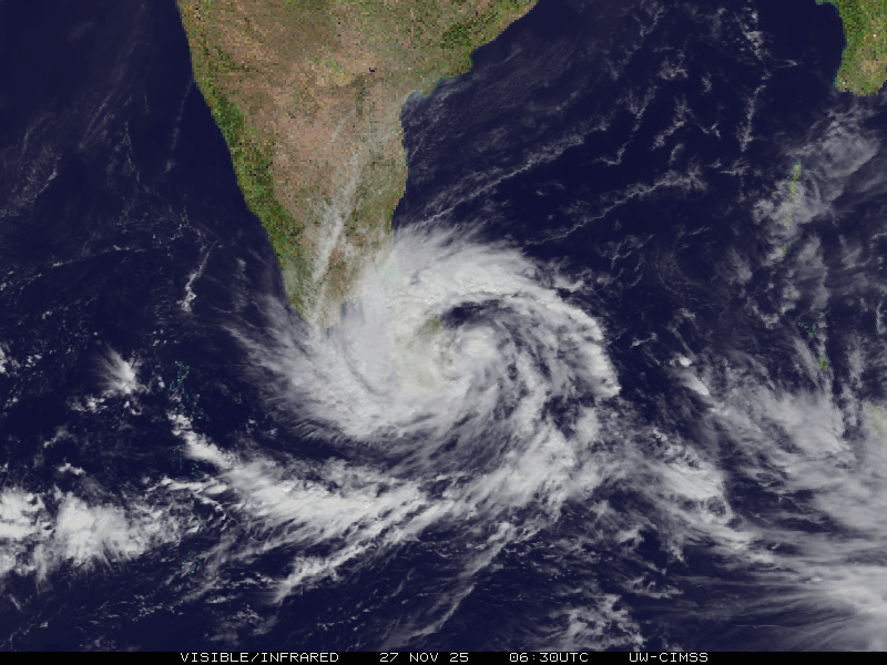
In major disasters, rapid response depends on two critical pieces of information: how many people are affected and where they are. This knowledge enables responders to prioritise aid delivery to the most vulnerable populations. Recent evidence from Sri Lanka shows that open population data from WorldPop helps answer these questions quickly and reliably. Cyclone Ditwah […]

How Open Population Data Makes a Difference in Crisis Response Read More »

Animation showing population distribution of Bogata under SSP1 scenario, 2025-2100

New Global 1 km Population Projections Released to Advance Climate and Health Research (Version 0.2)

As part of the Wellcome-funded FuturePop project, WorldPop has recently released a new open access dataset. The data includes gridded global population distribution maps at ~1 km resolution (30 arc-seconds) for every 5-year interval from 2025 through 2100, under each of the five Shared Socioeconomic Pathway (SSP) scenarios (SSP1-5). The projections feed into the Coupled

New Global 1 km Population Projections Released to Advance Climate and Health Research (Version 0.2) Read More »

AI art image of globe on a stage with 'Global 2' sign watched by a large audience

Discover the Power of Population Data: Join Our Upcoming Webinar

We’re thrilled to announce the launch of a ground-breaking open-access collection of high-resolution global demographic datasets (“Global 2”), available from 4 September 2025. Developed by the WorldPop programme at the University of Southampton, this new release delivers annual, age- and sex-disaggregated population estimates for 2015–2030, covering 242 countries and territories. This marks a major step

Discover the Power of Population Data: Join Our Upcoming Webinar Read More »