Capacity strengthening

Photo of conference hall with delegates at a UNICEF–MICS–WorldPop Regional Workshop for the Arab States in Amman, Jordan

Advancing National Survey Data with Geospatial Innovation in the Arab States

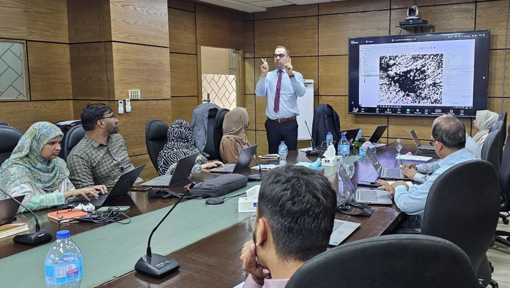
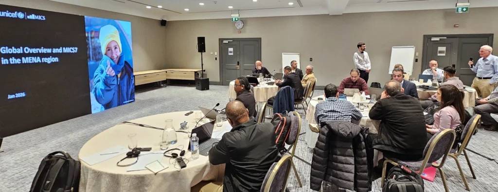
Last week in Amman, experts from across the Arab States came together for a pioneering UNICEF–MICS/WorldPop workshop on using geospatial methods to build modern national sampling frames. Co-led by Senior Research Fellow Dr Sarchil Qader and GIS Technician Iyanuloluwa Olowe with UNICEF GIS consultant Nazim Gashi, the workshop brought together senior officials and technical staff […]

Advancing National Survey Data with Geospatial Innovation in the Arab States Read More »

Photo of Cameroon DEGURBA workshop participants with completion certificates.

Skills for Smarter Planning: How DEGURBA Capacity Building Is Empowering Countries 

WorldPop recently completed its first workshop on automated census mapping in Malawi, a milestone for the joint FCDO-funded project with the Malawi National Statistics Office (NSO) ahead of their 2028 national census. Led by Dr Sarchil Qader and Dr Aubrey Steingrabber over two intensive weeks, 22 NSO colleagues and 4 students from the University of

Skills for Smarter Planning: How DEGURBA Capacity Building Is Empowering Countries  Read More »

Photo of Data Science Nigeria 2025 conference hall

The Future is Geospatial: Powering Africa’s Growth with Location Intelligence

On Tuesday, October 21, Senior Research Fellow Dr. Chris Nnanatu delivered a keynote presentation at the 2025 Data Science Nigeria AI Bootcamp, where he spoke on a topic shaping Africa’s digital future: “The Future is Geospatial: Powering Africa’s Growth with Location Intelligence (LI).” Dr. Nnanatu explored how geospatial and artificial intelligence (AI) technologies are transforming

The Future is Geospatial: Powering Africa’s Growth with Location Intelligence Read More »

Photo of street scene in Dhaka, Bangladesh

Advancing Wastewater Surveillance and Population Mapping at Dhaka Stakeholder Engagement Meeting

Dr Somnath Chaudhuri, Research Fellow at WorldPop, recently visited Dhaka to participate in a key stakeholder engagement meeting for the Gates Foundation-funded project Blue Line Tracing and Wastewater Surveillance in Dhaka. The initiative, a multi-institutional collaboration involving icddr,b (formerly known as the International Centre for Diarrhoeal Disease Research, Bangladesh), the University of Virginia, Imperial College

Advancing Wastewater Surveillance and Population Mapping at Dhaka Stakeholder Engagement Meeting Read More »

Photo of Dr Jessica Espey, Deputy Director (Research) delivering the Day 2 keynote address at Evidence25, Cotonou, Benin

Highlighting African Leadership in Evidence-Informed Policymaking at Evidence25

At the Africa Evidence Network Evidence 2025 conference in Cotonou, Benin last week, our Deputy Director (Research) Dr Jessica Espey delivered a keynote highlighting how Africa’s Regional Economic Communities (RECs) are using data and research to shape smarter policy decisions across the continent. Dr Espey, co-author of a forthcoming paper with four Sub-Saharan African colleagues

Highlighting African Leadership in Evidence-Informed Policymaking at Evidence25 Read More »

Photo of Dr Sarchil Qader leading a workshop for the Pakistan Bureau of Statistics

WorldPop: Sharpening Pakistan’s Survey Tools with Geospatial Know-How

We’re excited to be working side by side with Pakistan Bureau of Statistics (PBS) and UNFPA to modernise survey planning and sampling in Pakistan, through a strategic training programme focused on Advanced Sampling for Complex Integrated Specialized Household and Economic Surveys run by Senior Research Fellows, Dr Sarchil Qader and Dr Gianluca Boo. Dr Qader

WorldPop: Sharpening Pakistan’s Survey Tools with Geospatial Know-How Read More »

Photo of GIS Analyst Iyanuloluwa Olowe leading a workshop session

Geospatial Capacity Strengthening in Nigeria

To strengthen in-country capacity, WorldPop, supported by Gavi, recently conducted two capacity-strengthening workshops in Nigeria. Our geospatial experts Dr Edson Utazi and Iyanuloluwa Olowe led sessions focused on methodologies for producing gridded estimates of vaccination coverage and identifying zero-dose children. 38 participants from 11 organisations including the National Primary Health Care Development Agency, MOMENTUM Routine

Geospatial Capacity Strengthening in Nigeria Read More »

Research Fellow Dr Aubrey Steingraber guides workshop participants practice with geospatial tools to validate preEA boundaries and collect GPS household locations

Preparing a National Sampling Frame: capacity strengthening in Cameroon

Senior Researcher Dr Sarchil Qader and Specialist GIS Technician Dr Aubrey Steingraber have recently returned from Cameroon where they conducted an 8-day workshop and high-level engagement to support the development of a national sampling frame for the country. The lack of an up-to-date national sampling frame that accurately lists the businesses and household addresses needed

Preparing a National Sampling Frame: capacity strengthening in Cameroon Read More »