
Access to high-quality demographic data is often one of the biggest barriers to evidence-based decision-making. Whether supporting health service planning, humanitarian response, infrastructure investment, or climate adaptation, organisations need population data that is both current and spatially detailed.
That is why we are pleased to see selected demographic variables from WorldPop Global 2 now available through ArcGIS Living Atlas.
This latest integration builds on the longstanding collaboration between WorldPop and Esri, bringing our next-generation global population estimates directly into the workflows used by GIS professionals around the world. By making these datasets available within Living Atlas, users can more easily combine demographic intelligence with environmental, infrastructure, health, and socioeconomic data layers to support analysis and decision-making.
WorldPop Global 2 represents a significant advancement in global population mapping. Covering 242 countries and territories from 2015 to 2030, the dataset provides high-resolution population estimates at 100-metre resolution, disaggregated by age and sex. The release incorporates updated census information from the 2020 census round, improved settlement mapping, extensive building footprint data, and a new generation of geospatial covariates that enhance accuracy across both urban and rural environments.
For ArcGIS users, the availability of selected demographic variables in Living Atlas means that richer population insights can now be accessed without the need for separate data acquisition and processing pipelines. Analysts can explore demographic patterns, identify vulnerable populations, assess service accessibility, and support resource allocation decisions using authoritative, globally consistent population data.
The timing is particularly important. As governments and development organisations respond to rapid urbanisation, demographic change, climate pressures, and evolving public health challenges, the demand for transparent and regularly updated population data continues to grow. High-resolution demographic datasets are increasingly becoming foundational infrastructure for spatial analysis rather than specialist resources reserved for expert modelling teams.
Making WorldPop Global 2 data available through ArcGIS Living Atlas reflects a shared commitment to expanding access to open, actionable demographic evidence. We look forward to seeing how the ArcGIS community applies these data to address real-world challenges and deliver better outcomes for communities worldwide.
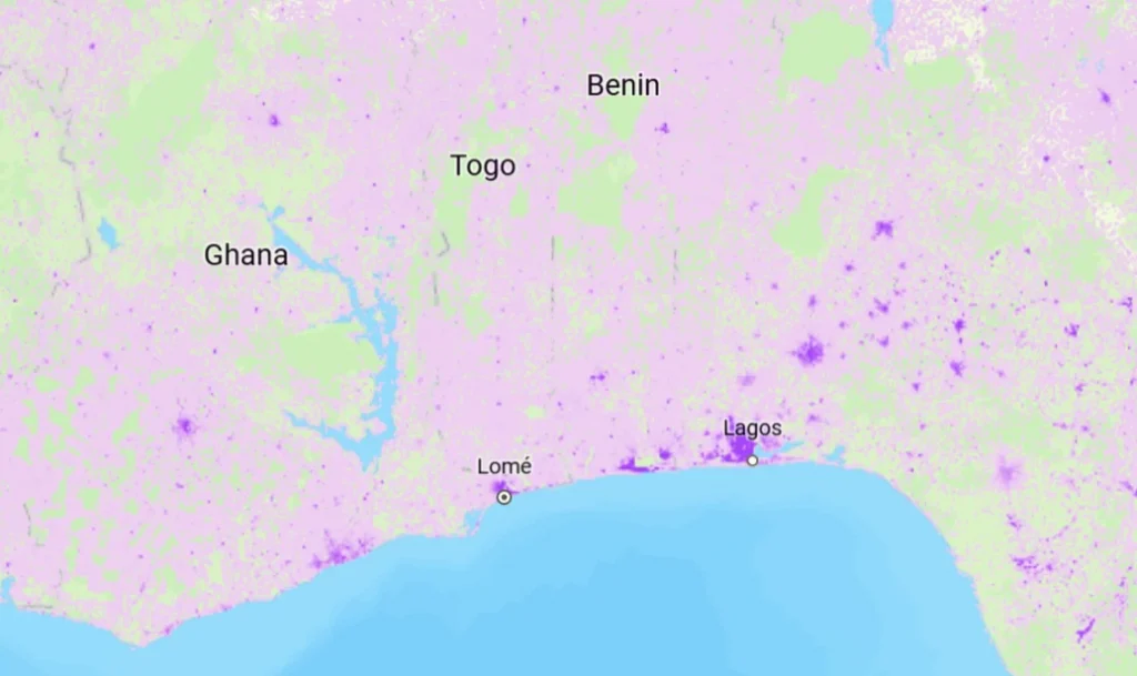
Image: Global Projected Count of Children Under Age 5 for 2030 derived from 1-km cell size WorldPop Global2, ArcGIS Scene Viewer, 2026.