Disaster Management

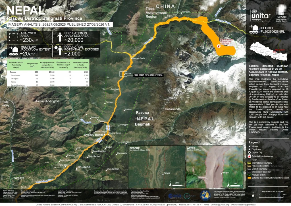
Map showing satellite detected Mudflow/ rockflow extent as of 26–27 August 2026 in Rasuwa District, Bagmati Province, Nepal.

Open Data Aiding Relief Efforts in Nepal and Tibet

Following recent devastating mudflows in Nepal’s Rasuwa District, WorldPop’s open spatial demographic data has been critical in rapidly assessing the human impact of the disaster.   By combining satellite imagery of the 20 km² affected area with WorldPop’s open demographic datasets, the preliminary analysis published by UNOSAT on ReliefWeb estimated that approximately 2,000 people were exposed […]

Open Data Aiding Relief Efforts in Nepal and Tibet Read More »
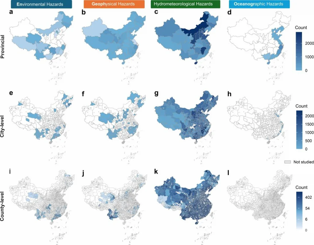
graphic showing spatial distribution of warning counts by hazard type

Researchers Launch Comprehensive Dataset of China’s Multi-Hazard Early Warnings

Répondez à notre enquête de satisfaction et contribuez à façonner la suite A team of international researchers, including experts from WorldPop, has released a groundbreaking dataset documenting over one million official early warning records across mainland China.  The Chinese Multi-Hazard Early Warning Dataset provides a standardized archive of over one million warning records issued between

Researchers Launch Comprehensive Dataset of China’s Multi-Hazard Early Warnings Read More »

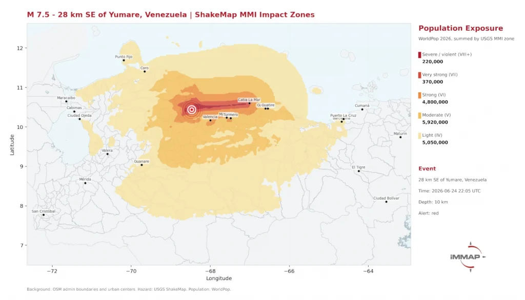
Impact map of Venezuela earthquake 24-06-2026

WorldPop Open population data supports humanitarian response after Venezuela earthquakes

Répondez à notre enquête de satisfaction et contribuez à façonner la suite When two powerful earthquakes struck near Yumare, Venezuela, on 24 June, humanitarian responders needed to understand quickly how many people had been affected and where support would be needed most. Open population data from WorldPop helped provide those critical early insights.  The earthquakes, measuring magnitude 7.2 and 7.5 just

WorldPop Open population data supports humanitarian response after Venezuela earthquakes Read More »

Photo of a young woman checking her smartphone in a busy Philippines market.

Transforming Social Media Signals into Accurate Population Maps for Crisis Response

An international research team led by Dr Paolo Andrich, a visiting researcher at WorldPop based at the University of Oxford, has developed a novel statistical framework to turn anonymised, biased social media data into reliable population estimates. This approach provides a timely and contemporary alternative to traditional censuses, which are often static and struggle to

Transforming Social Media Signals into Accurate Population Maps for Crisis Response Read More »

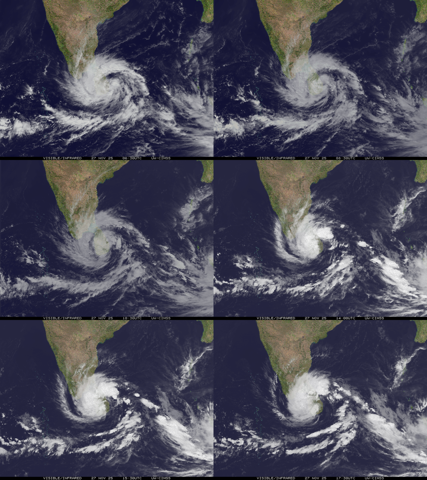
Visible infrared satellite loop of Cyclone Ditwah, by SSEC/CIMSS, University of Wisconsin–Madison

How Open Population Data Makes a Difference in Crisis Response

In major disasters, rapid response depends on two critical pieces of information: how many people are affected and where they are. This knowledge enables responders to prioritise aid delivery to the most vulnerable populations. Recent evidence from Sri Lanka shows that open population data from WorldPop helps answer these questions quickly and reliably. Cyclone Ditwah

How Open Population Data Makes a Difference in Crisis Response Read More »