
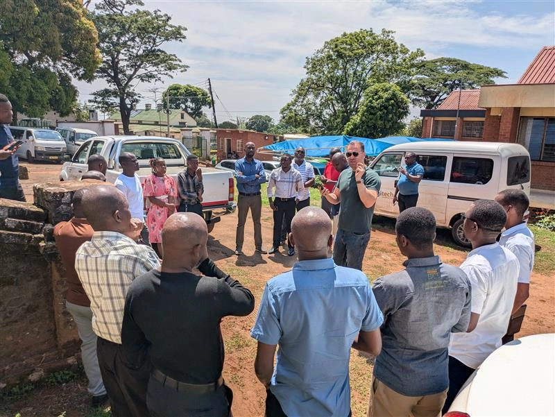
WorldPop recently completed its first workshop on automated census mapping in Malawi, a milestone for the joint FCDO-funded project with the Malawi National Statistics Office (NSO) ahead of their 2028 national census. Led by Dr Sarchil Qader and Dr Aubrey Steingrabber over two intensive weeks, 22 NSO colleagues and 4 students from the University of Malawi learned to use WorldPop’s geospatial tools and methods to help plan and map enumeration areas (EAs) more efficiently than ever before.
During the workshop staff were introduced to tools such as the preEA software and the Enumeration Effort Metric, which help automate EA delineation and provide estimates for the effort required to survey each census Enumeration Area. At the final-day presentations, participants demonstrated how this approach can improve accuracy, reduce costs and overcome many of the logistical challenges faced in earlier censuses.

The move towards automated mapping responds to a real challenge: for the 2028 census, Malawi’s NSO has indicated that full pre-census household listing (which used to rely on manual, resource-intensive enumeration) may no longer be feasible due to funding constraints. Instead, the plan is to lean on a data-driven, geospatial and machine-learning approach, integrating existing census information and recently collected household listing through national surveys with satellite-derived features and building footprint data to estimate population distribution across the country.
WorldPop brings a track record of supporting national censuses worldwide with high-resolution gridded population data and tools that convert that data into operational census infrastructure. The Malawi workshop represents a critical first step: not just training, but building local capacity for a modern, cost-efficient census methodology that could be adopted by other countries facing similar constraints.
Looking ahead, once the pilot EAs produced using the preEA tool have been validated on the ground by the NSO, WorldPop will refine the model and support full integration into census planning. If successful, this approach will help ensure that Malawi’s population counts remain accurate and inclusive, and that decision-makers have the best possible data to guide development, resource allocation, and service provision.
This workshop shows how innovative geospatial methods, paired with local capacity-building, can transform how census operations are planned – making them more efficient, scalable, and sustainable. For Malawi, and potentially many other countries, the future of census mapping is now more digital and data-rich than ever.
Learn more
- FCDO Malawi project
- WorldPop Brings Cutting-Edge Mapping Technology to Support Malawi’s 2028 Census
- Field Testing preEAs in the Democratic Republic of Congo
- A First Digital Census
- Exploring the automatic pre-Enumeration Areas Tool for surveys on forced displacement (Refugees)
- Benin adopts WorldPop’s ‘preEA’ tool to conduct its first modern, digitised census