
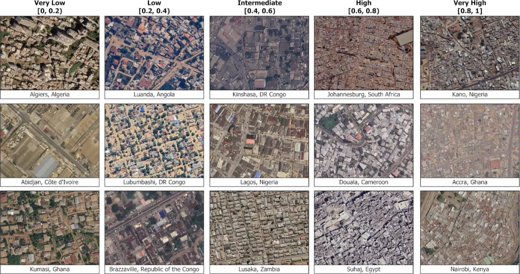
Researchers at WorldPop have developed a new way to reveal informal urban development that can be difficult to see in conventional data, potentially helping cities better target surveys, infrastructure and services.
The study, led by Research Fellow Dr Wenbin Zhang, uses open geospatial data and machine learning to map physical patterns associated with informal development across 84 African cities, at a detailed 10-metre resolution.
Informal settlements are often poorly represented in official data, particularly when small or fragmented areas are embedded within otherwise formally developed neighbourhoods. This can make communities less visible in the evidence available for urban planning and investment.
Rather than simply labelling areas as “formal” or “informal”, the researchers combined satellite imagery and building data to identify how strongly the physical characteristics of an area resemble patterns associated with informal development.
The findings reveal a complex urban picture. Areas with stronger signals of morphological informality do not always form large settlements. They can also appear as small, fragmented clusters within the wider city. At the highest probability level, 72.4 per cent of the identified area occurred in patches smaller than 1 km².
Independent testing using 1,910 reference locations across Ghana, Kenya, Malawi and Nigeria showed strong separation between formal and informal morphological patterns.
The research also highlighted discrepancies in how populations are represented. In 89 per cent of 308 community-mapped settlement areas, WorldPop 2023 population data allocated fewer people than were recorded by community data. However, because those community records span 2013 to 2020, the researchers stress that this should not be interpreted as evidence of a current population undercount.
Crucially, the maps are not intended to provide a definitive census of informal settlements. Instead, they offer an updateable source of evidence that could guide local validation, community mapping and surveys, helping planners better understand rapidly changing urban environments and make more informed decisions about infrastructure and investment.
Headline image: Representative satellite-image examples across the morphological-informality probability continuum.
Learn more
- Hidden and fragmented patterns of morphological informality across African cities revealed by open geospatial data (Computers, Environment and Urban Systems)
- Mapping zero-dose populations: conflict, remote rural, urban poor (WorldPop)
- FuturePop project (WorldPop)
- WorldPop API
- WorldPop AI-powered Portal
- WorldPop Open Data
- WorldPop Free Learning Resources