
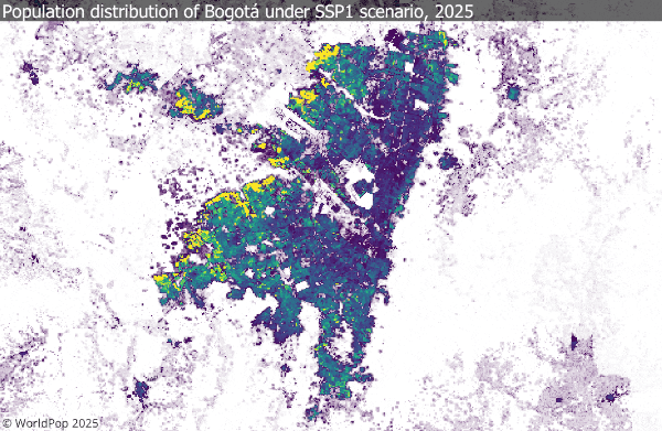
As part of the Wellcome-funded FuturePop project, WorldPop has recently released a new open access dataset. The data includes gridded global population distribution maps at ~1 km resolution (30 arc-seconds) for every 5-year interval from 2025 through 2100, under each of the five Shared Socioeconomic Pathway (SSP) scenarios (SSP1-5). The projections feed into the Coupled Model Intercomparison Project (CMIP) – a global collaborative framework that compares climate models to better understand past, present, and future climate change – and match national-level totals provided for each SSP and then allocate those totals spatially based on sub-national estimates and settlement growth modelling.
These high-resolution projections make it possible to analyse potential future population patterns (density, settlement expansion, regional demographic change) at a finer spatial scale than national totals alone. They are aligned with climate-model frameworks (via the SSPs) and so may be useful in integrated assessments of population + climate + health and development futures, and offer a consistent global dataset, facilitating comparative work across countries and regions.
- Researchers and practitioners could apply these data in a range of contexts, such as:
- Climate impact and adaptation modelling: Estimating population exposure to hazards such as flooding, heat, or sea-level rise under alternative SSPs.
- Urban growth and land-use planning: Exploring how settlement patterns may expand or contract, helping to assess infrastructure needs or urban footprints.
- Health and epidemiology: Linking projected population distributions with climate or environmental models to anticipate potential disease risks or vaccination and healthcare demands.
- Energy and resource demand analysis: Estimating spatial shifts in energy use, water demand, or food security pressures.
- Integrated assessment models (IAMs): Using consistent spatial population inputs that align with the CMIP/SSP framework for scenario comparison.
Users should take account of some important caveats:
- Version 0.2 is explicitly an early release. The data are offered “on a ‘where is, as is’ basis; do not offer an express or implied warranty of any kind… do not guarantee the quality, applicability, accuracy, reliability or completeness of any data provided.”
- As with all gridded population models, the spatial allocation is modelled, so the finer the grid the more uncertainty. This is especially so in rapidly changing or informally settled areas. For example, previous evaluations of WorldPop gridded datasets found significant cell‐level errors in urban slum contexts.
- The underlying national projections themselves are uncertain (as all long‐term demographic forecasts are). Disaggregating them spatially increases the chain of assumptions.
- Users should check how well the dataset fits their regional/local context (especially for small area work) and ensure the assumptions are acceptable for their application.
Further updates are in the pipeline: improved versions will incorporate newer data, updated covariates (e.g., building footprints, enhanced settlement growth modelling) and potentially higher spatial resolution. Beyond this, age and sex breakdowns and quantitative measures of uncertainty are planned. Users who adopt version 0.2 should consider it a baseline for experimentation and analysis, while treating results with appropriate caution and ideally combining them with other data sources or local validation where possible.
If you use this data and spot something odd, we urge you to get in touch. E-mail: release@worldpop.org if you find potential errors or have concerns. Your feedback will directly help us improve the next versions.
We’re trialling the ‘Deep Dive’ audio summary feature of Google’s NotebookLM. This feature uses AI to create a podcast-like audio conversation between two AI-derived hosts that summarise key points of documents - in this case the “Global 1 km-grid population projections for 2025-2100 consistent with the Shared Socioeconomic Pathways (SSPs) national population projections, version 0.2” open data release listed below.
As Google acknowledge that NotebookLM outputs may contain errors, we have been careful to check, edit and validate this audio.
Please contact us to let us know what you think.
Music: My Guitar, Lowtone Music, Free Music Archive (CC BY-NC-ND)