We are just a few days away from the start of the #30DayMapChallenge, which begins next Tuesday, 1 November. Initiated in 2019 by Finnish geographer and map designer Topi Tjukanov, this year we are sharing a variety of maps from across the WorldPop team. For each map we’ll try to share some information on the data sources that have been used in the map and we’ll post all our contributions on Twitter using the hashtag #30DayMapChallenge.
Nearly all the open datasets that WorldPop produces are geospatial in nature, and many are well-suited to the themes of this year’s challenge. We have a lot of raster datasets, we have global datasets, we have polygons datasets, datasets for islands, movement, datasets at a variety of scales. Fantasy or music maps are not exactly our core data products, but we’re up for the challenge. If you too want to join in with the #30DayMapChallenge – we’ve compiled a list of datasets that you might find useful for creating your topographic depictions, atlases, plans, projections, geospatial animations etc. We’d love to see what you make using WorldPop open datasets, so please tag us in your posts on Twitter (@WorldPopProject).
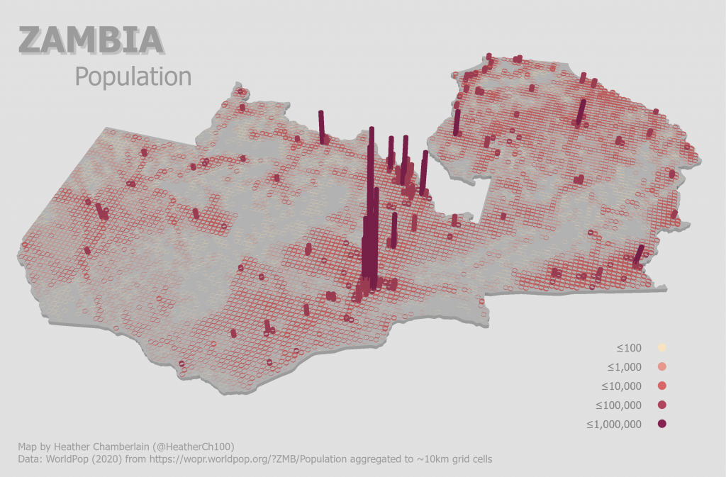
3D Zambia Population Map by Heather Chamberlain. Using WorldPop and GRID3 open data (https://wopr.worldpop.org/?ZMB/Population aggregated to ~10km grid cells)
In the past three years the 30 Day Map Challenge has burgeoned into a global playground, as can be seen from the variety of contributions to last year’s challenge. There are no prizes, just the possibility of gaining the esteem and admiration of fellow mapmakers.