Mapping Human Impact: WorldPop Open Data Powering Global Journalism
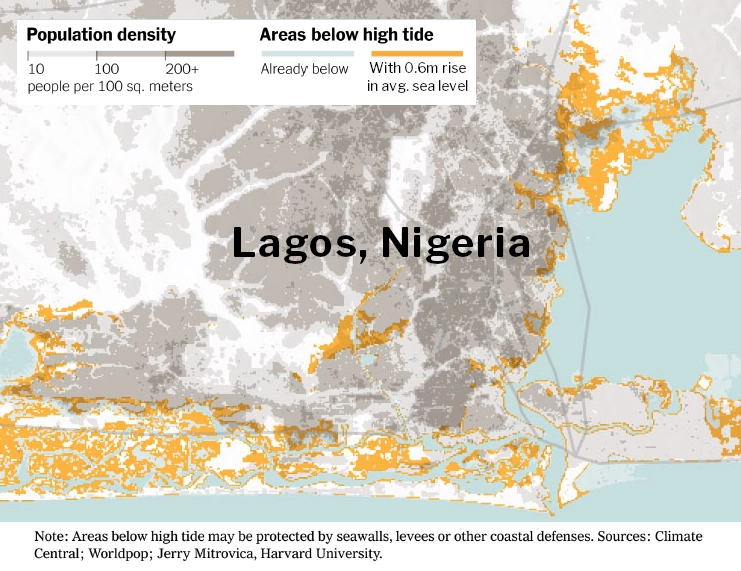
Take Our Survey and Help Shape What Comes Next At WorldPop, our mission is to ensure that every person is mapped and counted in decision making, providing the high-resolution open-access data necessary to tackle the world’s most pressing challenges. Increasingly, our datasets are becoming a cornerstone for data-driven journalism, helping newsrooms translate complex scientific projections into tangible human […]
Mapping Human Impact: WorldPop Open Data Powering Global Journalism Read More »