
Researchers at WorldPop have pioneered a new mathematical model that significantly improves the accuracy of geospatial mapping for rare and endangered habitats.
The study, published in the International Journal of Geographical Information Science, introduces the Entropogram-based Random Field (ERF) model. This tool addresses a critical gap in environmental monitoring: the tendency of traditional mapping methods to “oversmooth” data. When maps are oversmoothed, small but vital features like wetlands, riparian buffers, or narrow woodland corridors are often swallowed up by more dominant categories.
These rare classes play a disproportionately large role in biodiversity, ecosystem health, and conservation planning. Ensuring they are accurately represented is essential for contemporary decision-making.
Lead author, WorldPop Senior Research Fellow Dr Wenbin Zhang comments: “Our model ensures accuracy by balancing local details with broader regional patterns. This allows us to recover rare classes that are often environmentally significant but difficult to detect with standard tools”.
The ERF model uses an “entropogram,” a measure derived from information theory that captures how different land-cover classes co-occur across a landscape. By using this data, the model can predict complex spatial patterns without the high computational costs of previous methods.
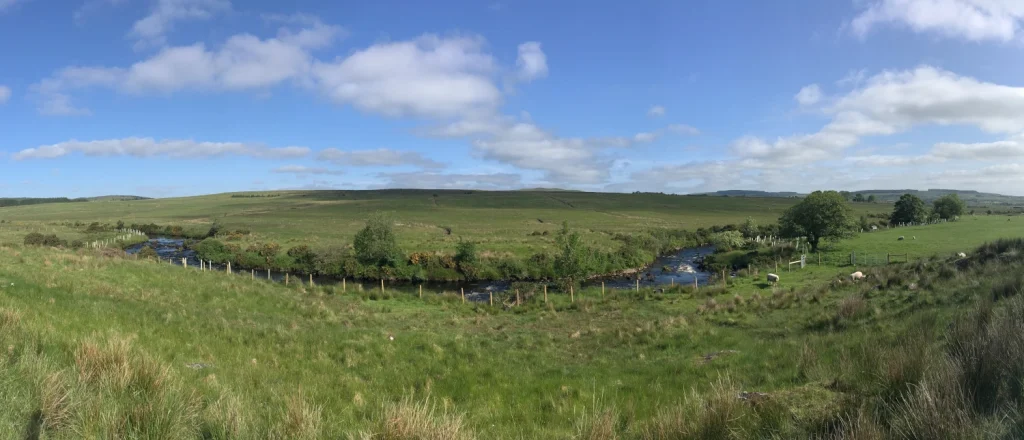
The team tested their model using a high-resolution 1km grid cell land-cover map of Northern Ireland. While traditional methods often failed to detect rare categories like coastal areas or broadleaf woodlands, the ERF model successfully recovered these patches. Crucially, it preserved the realistic “mosaic” structure of the landscape rather than creating simplified, artificial blocks of data.
This new approach is both scalable and computationally efficient, making it a practical choice for large-scale geospatial mapping projects. As global environmental challenges increase, the ability to produce timely and accurate data on habitat connectivity and land-use change has never been more urgent.
This research was supported by the National Natural Science Foundation of China, Horizon Europe, and the U.S. National Science Foundation.
The full paper, An entropogram-based Random Field model for categorical geospatial data prediction, is published in the International Journal of Geographical Information Science. This work builds on earlier research that developed the entropogram as a function of spatial lag to measure spatial association (Spatial Association from the Perspective of Mutual Information) and further investigation into its properties in terms of scale effects (Scaling Geospatial Data from the Perspective of Complexity: Exploring the Scaling Behavior of the Entropogram).
We’re trialling the ‘Deep Dive’ audio summary feature of Google’s NotebookLM. This feature uses AI to create a podcast-like audio conversation between two AI-derived hosts that summarise key points of the document - in this case the full journal article linked above.
As Google acknowledge that NotebookLM outputs may contain errors, we have been careful to check, edit and validate this audio.
Please contact us to let us know what you think.
Music: My Guitar, Lowtone Music, Free Music Archive (CC BY-NC-ND)