
Understanding where and how populations are distributed, and how they shift over time, is at the heart of planning for health services, responding to disasters, designing cities, and tackling global challenges like climate change. WorldPop’s mission has always been to make high-resolution population and demographic data openly available, and the latest batch of global datasets represents a significant step in that work.
At the core of this new generation of data is WorldPop Global 2, a set of high-resolution geospatial population datasets covering 2015–2030. Built using the latest census information, satellite-derived settlement data and advanced modelling techniques, these annual estimates map populations at 100×100m resolution for more than 240 countries and territories – including age and sex breakdowns where source data allow. This means researchers, governments and humanitarian teams can see not just how many people live in a place, but who those people are and how their distributions change over time.
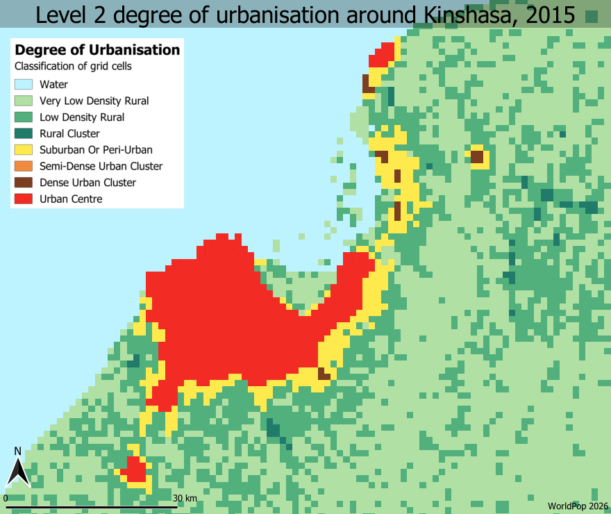
One exciting new product based on Global2 is multitemporal degree of urbanisation maps, produced using the GHSL GHS-DUG tool in combination with WorldPop’s gridded population counts. These datasets classify areas into urban and rural types at a 1 km resolution, capturing how urban and rural landscapes evolve over the 2015-2030 period – a vital tool for planning infrastructure, services, and sustainable development.
By releasing this rich suite of open data, WorldPop is helping fill a key gap in global information systems: detailed, consistent, and freely available maps of where populations are and how living environments are changing. Whether you’re a curious student, a city planner, a public health specialist, or a humanitarian responder, these resources open a window into the dynamic tapestry of human settlement and movement across our planet.
Headline image: Level 2 degree of urbanisation around Kinshasa, 2015-30.