
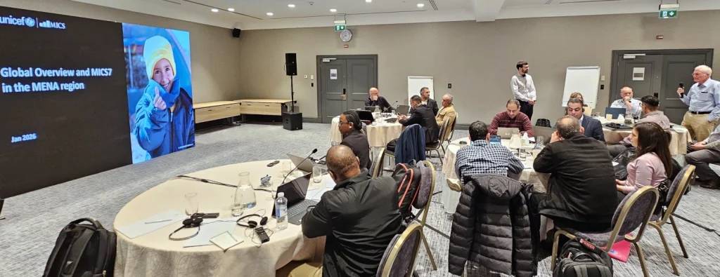
Last week in Amman, experts from across the Arab States came together for a pioneering UNICEF–MICS/WorldPop workshop on using geospatial methods to build modern national sampling frames. Co-led by Senior Research Fellow Dr Sarchil Qader and GIS Technician Iyanuloluwa Olowe with UNICEF GIS consultant Nazim Gashi, the workshop brought together senior officials and technical staff from national statistics offices in Syria, Palestine and Libya. Through hands-on sessions, participants explored how modern geospatial tools can be used to develop national sampling frames that are more accurate, cost-effective and scalable than traditional approaches.
Sampling frames are the backbone of household surveys. They determine which communities are visited and whose experiences are captured. Using GIS-based methods developed by WorldPop, participants learned how satellite imagery, spatial data and innovative modelling can help ensure that both urban and hard-to-reach populations are properly represented.
“Good surveys start with good foundations,” said Dr Qader. “By using geospatial innovation, we can help countries build sampling frames that are more inclusive, more efficient and better suited to today’s realities.”
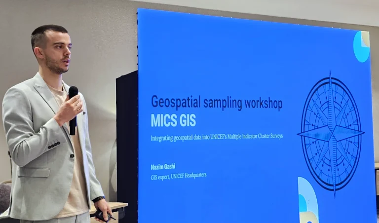
A major highlight was Syria’s progress toward launching its first nationwide digital sampling frame – a historic milestone made possible by these innovations. This achievement builds on a broader plan of joint UNICEF–WorldPop capacity-building. Following the regional workshop, a country-specific technical workshop for Syria was run that focused on using WorldPop’s Pre-Census Enumeration Area (PreEA) and Enumeration Effort Model (EEM) tools. These hands-on sessions are supporting national teams to prepare spatial datasets, design enumeration areas and plan efficient fieldwork in preparation for MICS 2026, future household surveys and the next national census.
The work supports the Multiple Indicator Cluster Surveys (MICS) programme, a global initiative led by UNICEF that helps countries collect high-quality, internationally comparable data on the wellbeing of children and women. MICS surveys cover critical areas such as health, education, nutrition and child protection, providing essential evidence for national planning and tracking progress toward the Sustainable Development Goals. Recent MICS efforts in Syria and Palestine have also demonstrated the growing role of geospatial data in improving transparency and analysis.
Beyond technical outcomes, the workshops showcase the impact of applied science at the University of Southampton and the value of partnerships that turn research into real-world solutions. WorldPop looks forward to continuing collaboration with UNICEF and national partners to strengthen capacity, support MICS implementation and advance geospatial innovation for reliable, people-centred data.
Learn more
- WorldPop Data Portal
Access high-resolution population data used for survey design, planning and SDG monitoring. - WorldPop Data Hub
Explore and download open demographic and geospatial datasets from around the world. - Geospatial Tools & Services
GIS services, APIs and plugins supporting national statistical offices and partners. - WorldPop Learning Resources
Build your geospatial skills with free, expert-led, self-paced materials. - WorldPop PreEA case study
How the preEA tool uses satellite, infrastructure and population data to automatically delineate enumeration areas.