
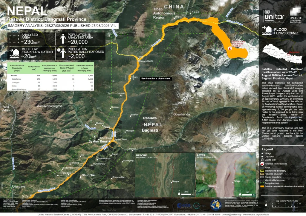
Following recent devastating mudflows in Nepal’s Rasuwa District, WorldPop’s open spatial demographic data has been critical in rapidly assessing the human impact of the disaster.
By combining satellite imagery of the 20 km² affected area with WorldPop’s open demographic datasets, the preliminary analysis published by UNOSAT on ReliefWeb estimated that approximately 2,000 people were exposed to, or living near the landslide and flood zones.
This mapping enabled highly localized exposure metrics, identifying 1,162 affected residents in Gosaikunda Rural Municipality and 665 in Uttargaya Rural Municipality.
By integrating satellite observations with high-resolution population data, humanitarian organisations can move quickly from mapping where a disaster has occurred to understanding who may be affected. As UNOSAT notes, the results are a preliminary analysis and have not yet been validated in the field, highlighting the importance of combining remote sensing with local ground feedback.
This example demonstrates how freely available WorldPop data can help transform satellite imagery into actionable information, supporting faster and more informed humanitarian response in remote and disaster-affected regions.
Image: Satellite detected Mudflow/rockflow extent as of 26–27 August 2026 in Rasuwa District, Bagmati Province, Nepal, 2026 (ReliefWeb).