
Rapid urban growth is transforming cities across the Global South. But in many places, official property and land-use records are outdated, or do not exist at all. This makes it difficult for authorities to plan new roads, schools, utilities or emergency services.
New WorldPop research led by Dr Wole Ademola offers a practical solution. Using satellite-derived building data and machine learning techniques, the study demonstrates how cities can be mapped according to how buildings are actually used – helping planners better understand where people live, work and access services.
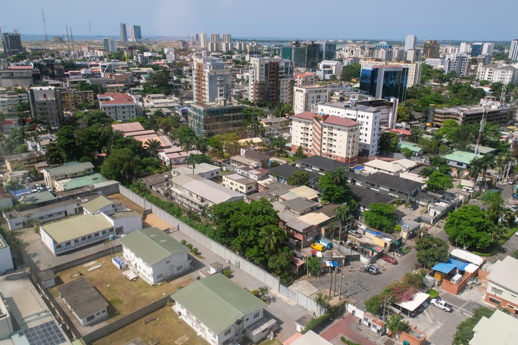
The research focuses on Lagos, Nigeria, one of Africa’s fastest-growing cities. Rather than relying on incomplete administrative records, the team used building “footprints” (digital outlines of structures captured from satellite imagery) to analyse patterns across the city.
By combining these footprints with computer models, the researchers classified neighbourhoods into three broad categories:
- Residential – primarily homes
- Non-residential – primarily commercial or business areas
- Mixed-use – buildings and areas that combine living and working spaces
Importantly, the study treats urban areas as a “mixture” of functions rather than assigning each location a single label. This reflects the reality of modern city life. In many neighbourhoods, a building might house shops on the ground floor and apartments above. Capturing this complexity provides a more accurate picture of how cities operate.
This detailed understanding of urban function has practical benefits. Identifying where residential and commercial activities overlap can help planners design transport networks, allocate public services and anticipate infrastructure needs. It also strengthens disaster preparedness by improving knowledge of where people are likely to be during the day or night – crucial for emergency response planning.
As cities continue to expand rapidly across the Global South, timely and reliable geospatial data is increasingly important. By harnessing satellite imagery and digital tools, this research helps make urban growth visible – supporting more informed, equitable and resilient planning decisions.
Headline image: Lagos, Nigeria by Francisco Anzola, 2024 CC BY 2.0
Learn more
Classifying urban areas into residential, non-residential and mixed-use proportions using building footprints and geospatial models (preprint – Research Square)
Geospatial Tools & Services
GIS services, APIs and plugins supporting national statistical offices and partners.- WorldPop Learning Resources
Build your geospatial skills with free, expert-led, self-paced materials.