With financial support from the World Bank, WorldPop researcher, Dr Sarchil Qader adopted a ‘preEA Tool’ to create a national sampling frame to serve multiple upcoming socio-economic surveys in the Democratic Republic of Congo (DRC).
Enumeration Areas (EAs) are small areas of a country that are used to administer surveys and censuses. Individual EAs are typically areas that can be canvassed by a single data collector. Getting EAs right is vital for a country to efficiently survey their population, but in the DRC (where the last census was conducted over 35 years ago) EAs are incomplete, outdated or missing. Creating and updating EAs is a very labour and cost-intensive activity. They are usually developed manually by either digitising small areas using satellite imagery, or by walking each area and noting its physical characteristics.
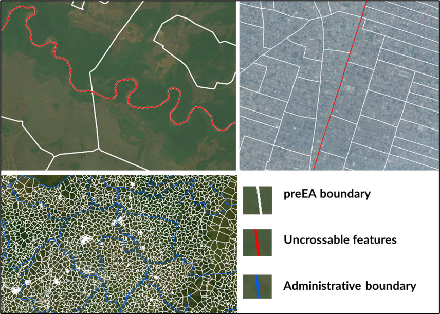
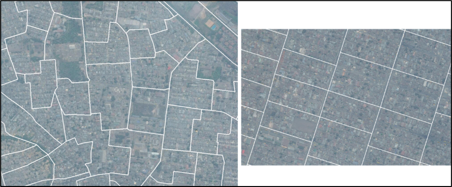
Dr Qader has developed a user-friendly ‘preEA Tool’ that can be employed to generate draft EA boundaries automatically to support census cartography. The approach involves using high-resolution gridded population and settlement datasets, GPS household locations, building footprints and uses publicly available natural, man-made and administrative boundaries. This method has the potential to save a considerable amount of time, labour and cost – enabling data collectors to work more efficiently in the field.
Example preEA tool output, where urban and rural preEA outlines are meeting standard criteria such as preEAs are nested within the administrative boundary and the preEA boundaries are respecting uncrossable features such as major roads and rivers