Ebola

This page provides access to WorldPop datasets and images for West African countries covering population distributions and mobility patterns to support efforts in controlling the ongoing ebola virus outbreak. They are updated according to the date of the posting – keep checking back for updates and new datasets. For the latest information on the outbreak, go to Healthmap’s ebola page.

09.09.14: Mobile phone flow maps 2

Below are some example population mobility maps derived from anonimized mobile phone call detail record (CDR) datasets. Further details on methods for measuring human movements from CDRs and example applications can be found on the Flowminder website. Further information on these maps and the production of additional metrics and analyses should be directed to Dr Andy Tatem or Dr Linus Bengtsson.

30.08.14: Mobile phone flow maps 1

Below are some example population mobility maps derived from anonimized mobile phone call detail record (CDR) datasets. Further details on methods for measuring human movements from CDRs and example applications can be found on theFlowminder website. Further information on these maps and the production of additional metrics and analyses should be directed to Dr Andy Tatem or Dr Linus Bengtsson.

Here we provide version 1 Flowminder (www.flowminder.org) human mobility models for West Africa, built on WorldPop population data, to support ongoing efforts to control the ebola outbreak. Before downloading any data, please read the documention carefully as it provides details on the datasets and models provided through the links below.

19.08.14: Population age structures, births and pregnancies

Each of the below country images now have an additional link to enable download of high resolution 2014 population datasets by 5-year age groupings, as well as estimated numbers of births and pregnancies.

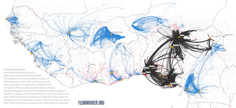
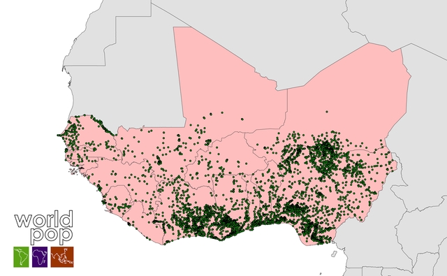
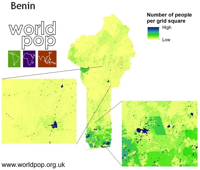
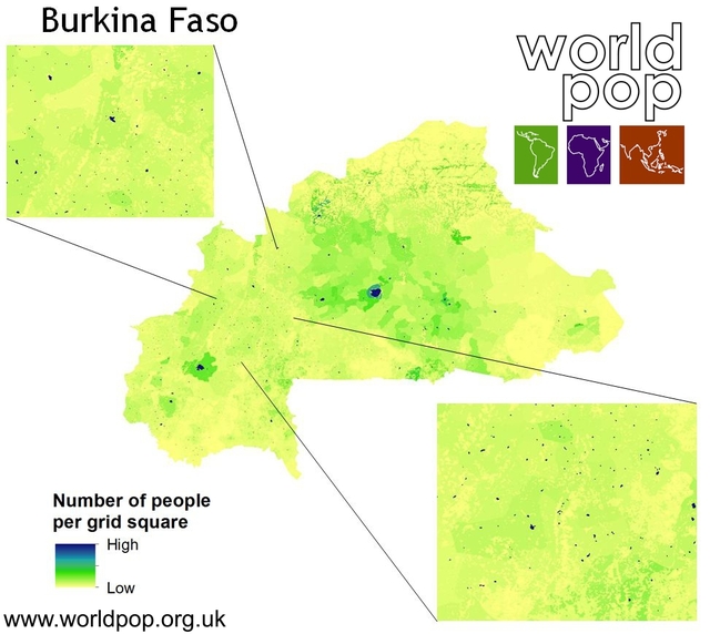
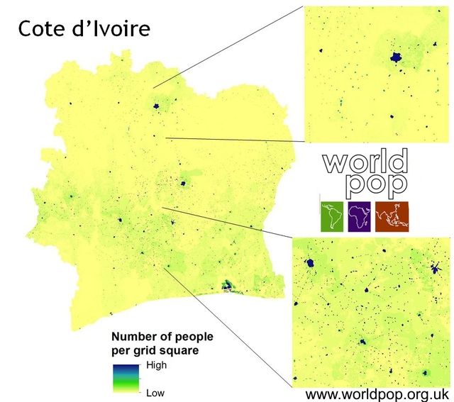
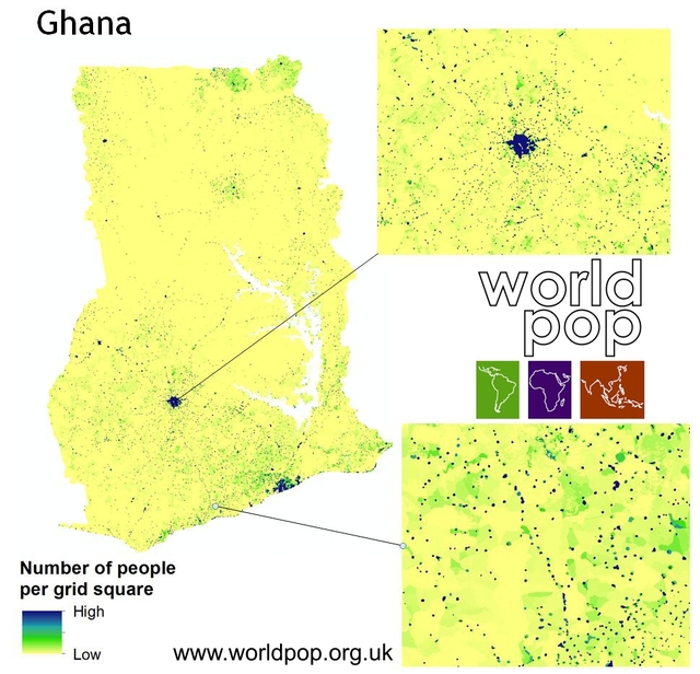
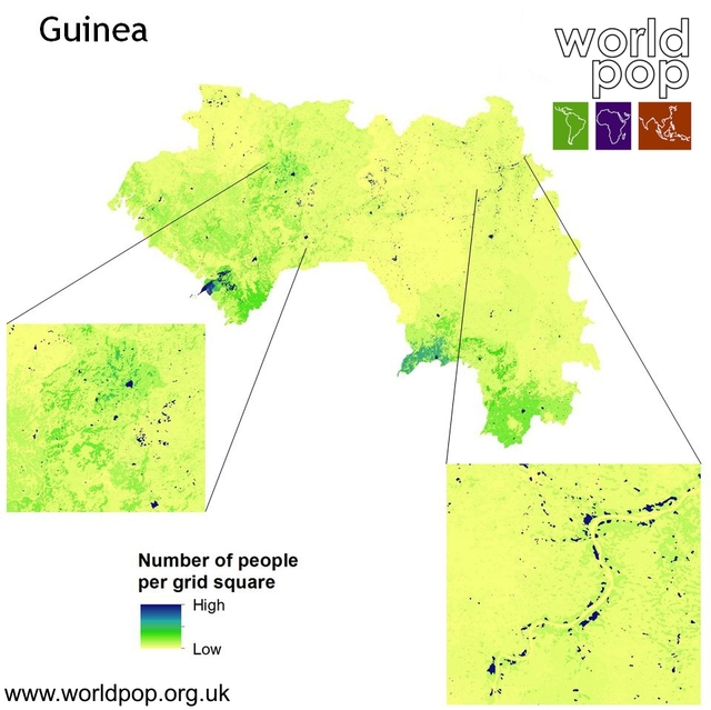
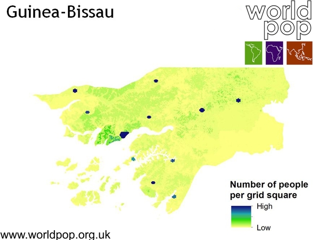
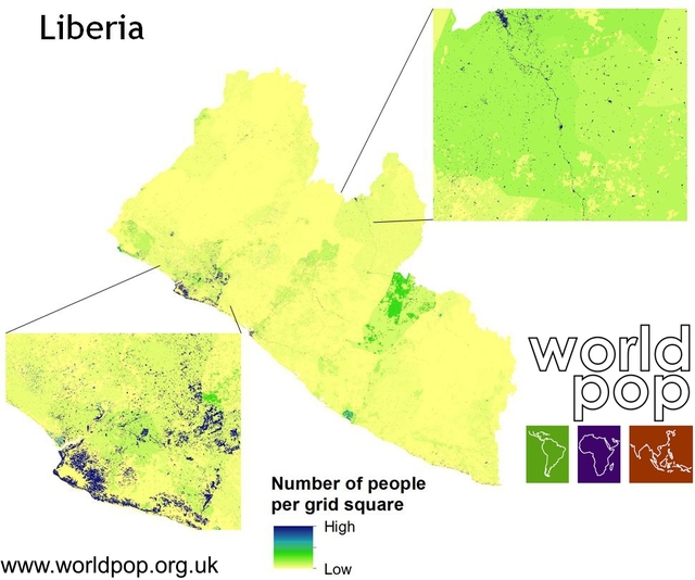
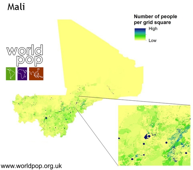
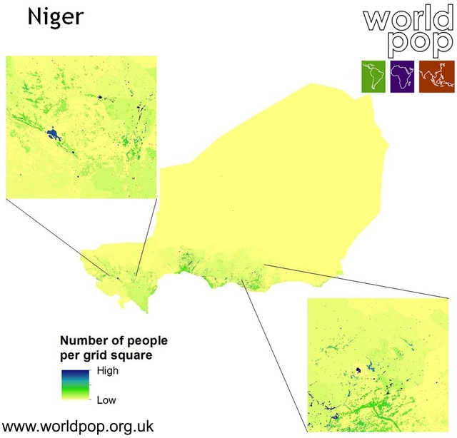
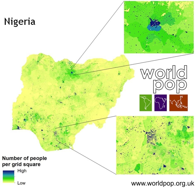
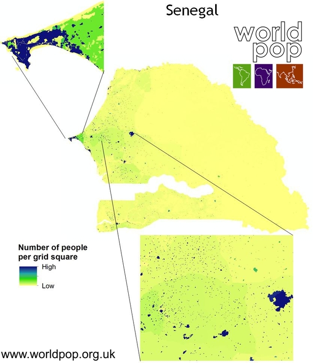
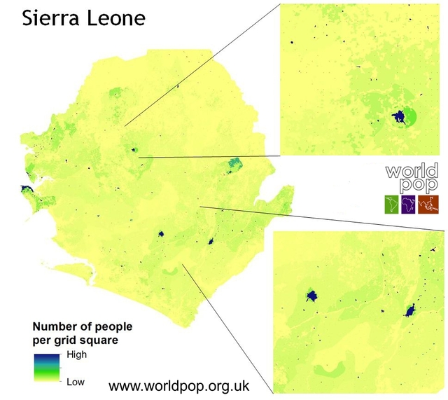
11.08.14: Locations of major settlements

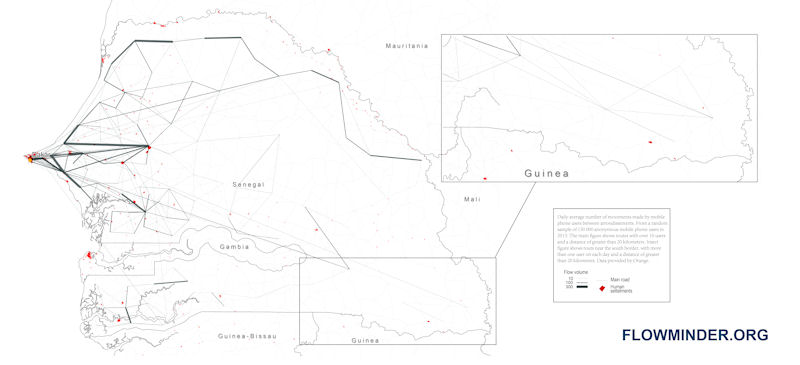
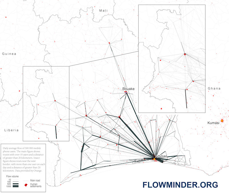
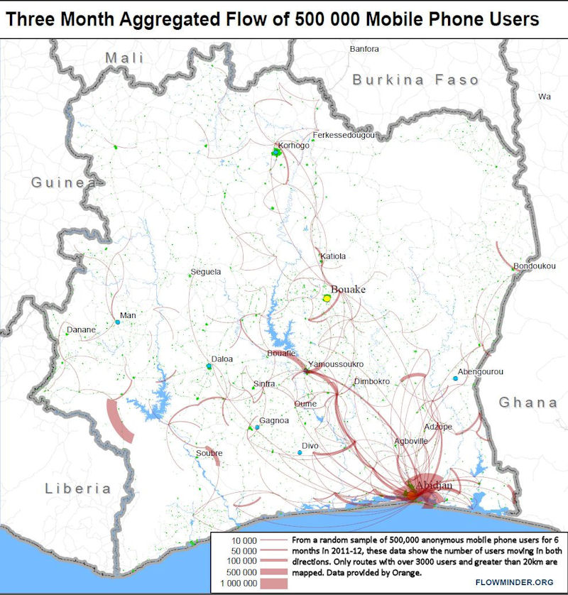
The location of over 5,000 major settlements in the West Africa region is available as a GIS shapefile through clicking on the below image. The data are derived from a combination of WorldPop urban settlement data and additional processing of global datasets.

The images below show newly created WorldPop datasets of estimated population counts per 100m x 100m grid cell for West African countries, adjusted to match the latest UN estimates for 2014. Click on each image to see a larger version and download link – the links provide free access to download the geotiff format datasets alongside descriptions of the features of the data, and the WorldPop methods page provides information on the approaches and input datasets used to construct them.