
Winning the fight against polio
Polio is a highly infectious disease caused by a virus that can cause total paralysis in a matter of hours. Mass vaccination campaigns since the 1950s has eliminated wild poliovirus from many parts of the World by 2000, but it remained prevalent in parts of Africa. Across the 2010s Nigeria had the largest reservoir of virus, with evidence of cases being exported to other countries across the continent. Efforts were therefore made to step up vaccination rates, particularly in hotspots across northern Nigeria. The campaigns initially used official population estimates that were projected from the 2006 census to assess how much vaccine would be needed and where to distribute it. Vaccination teams however quickly found that these population data were inaccurate, with many children missing.
Starting in 2015, WorldPop partnered with the Bill and Melinda Gates Foundation and Oak Ridge National Laboratories to support polio elimination efforts in Nigeria through the development of census-independent population mapping methods in the north of the country, making use of satellite imagery. The small area estimates produced fed into vaccination plans and tracking systems, were found to be substantially more accurate than census projections, and in some cases resulted in remote communities being mapped and counted for the first time.
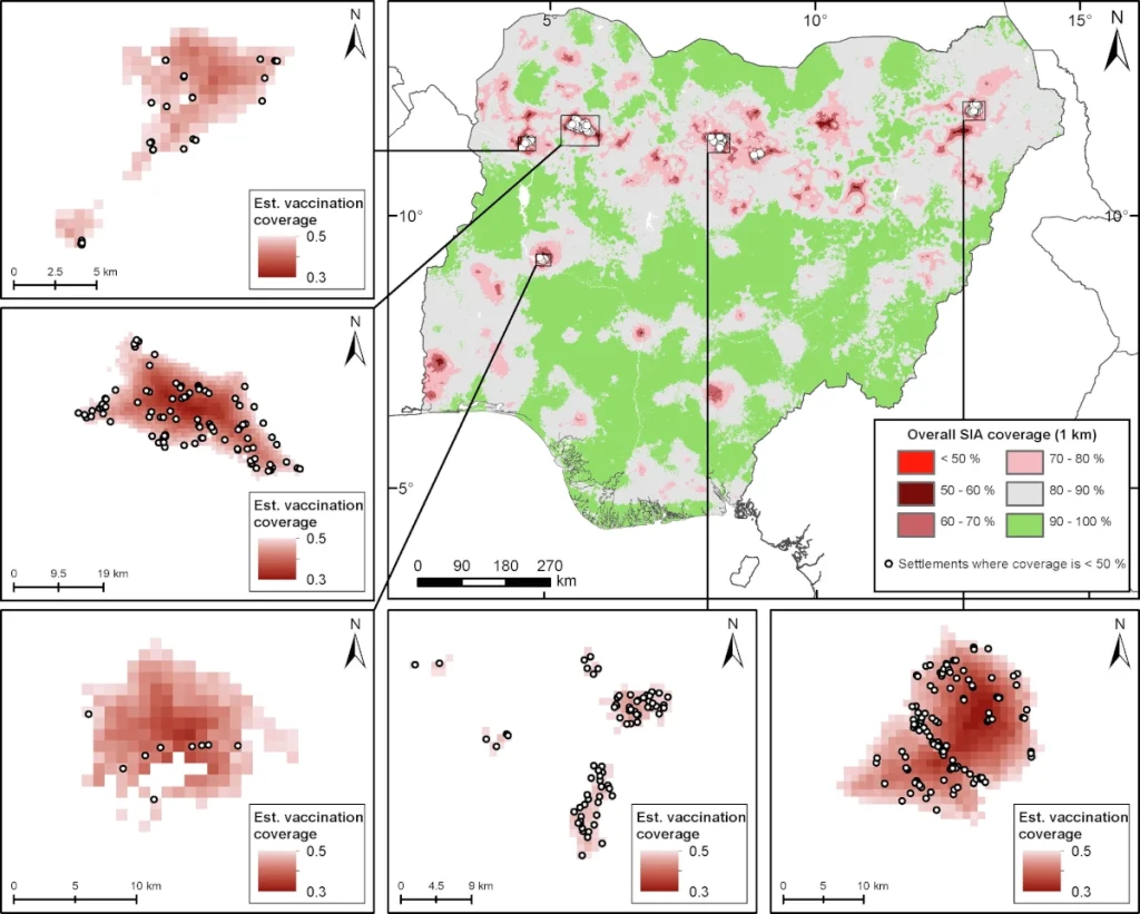
The vaccination campaigns were successful, and in 2020 Nigeria was declared to be free of wild poliovirus. Subsequent analyses have credited the satellite-based approaches as playing a major role in this success, resulting in net socioeconomic benefits of between $46.0 million and $153.9 million for a single year on top of health benefits. The work, and similar modelling work in Afghanistan led to the establishment of the GRID3 program, which strengthened collaborations with the Nigerian government around core geospatial data layer production. WorldPop has since partnered with organizations such as the National Primary Healthcare Development Agency (NPHCDA), National Bureau of Statistics, and Centers for Disease Control on method development and the production of small area estimates of vaccination coverage. The methods and outputs have been used by NPHCDA to guide and prioritise areas for campaigns to reach children with lifesaving vaccines.
Further information
- National population mapping from sparse survey data (PNAS)
- Mapping the distribution of zero-dose children to assess the performance of vaccine delivery strategies and their relationships with measles incidence in Nigeria (Vaccine)
- Examining the value of satellite data in halting transmission of polio in Nigeria: A socioeconomic analysis (Data and Policy)