Population dynamics
Population censuses taken every decade provide a single snapshot of the distributions of populations across a country. People rarely stay still however, and knowing where they are is of primary importance for accurate impact assessments, particularly those focused on population health, food security, climate change, conflicts and natural disasters. Substantial shifts in population distributions occur between day and nighttime, weekdays and weekends, holidays and workdays and across seasons and years. Previously we have had no way to capture and quantify these variations at fine spatial and temporal scales across entire countries, but the advent of new digital datasources is changing this.
Mobile network data
Anonimised mobile phone call data records offer a new datasource for understanding and measuring the dynamics of population distributions across countries. With more mobile phones on the planet than people and phone subscriptions reaching large percentages of the population, even in the poorest countries, such data represent a valuable resource for understanding population dynamics. Every time a communication is made or received, it is routed through the nearest tower to the user, indicating the presence of a person within the radius of that tower. With millions of users and billions of communications every day across thousands of towers, unprecedented data on population level activities are produced.Watch our video below to get more information:
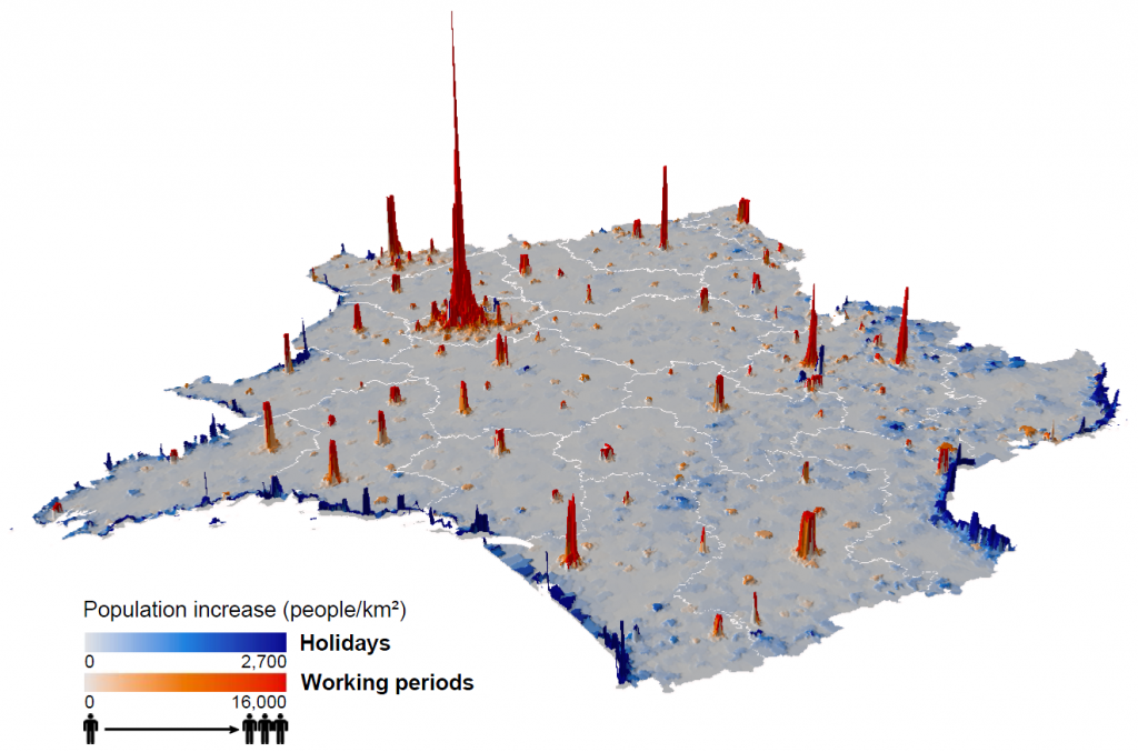
WorldPop, in collaboration with the Flowminder Foundation, have developed methods to translate the billions of anonymous mobile communications into population maps that show similar levels of spatial accuracy as census data. Moreover, not only can accurate population maps be produced in the absence of census data, but the continual record of the mobile network data enables production of these maps for any time period, with examples shown below and in the video.
Extending to low and middle income settings
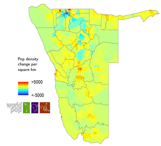
The analyses undertaken in France and Portugal enabled testing of methods against detailed and reliable census validation data. It is in the poorest areas of the World though where reliable data on population distributions and dynamics are most lacking and needed. Here, WorldPop and Flowminder are working to extend the mobile data methods to many low and middle income settings, along with assessments of alternative and complimentary datasources, such as dynamic satellite data. An example output for Namibia can be seen below, built in collaboration with the National Vector-borne Disease Control Program, MTC and the Clinton Health Access Initiative, in order to assess changing health facility catchment denominators.
Map of predicted population distribution in Namibia through integration of mobile network data and satellite/GIS covariates built using the WorldPop random forests modelling framework