Decades of conflict and instability has meant that it has not been possible to conduct a national population and housing census in Afghanistan since 1979. Current official government population statistics are largely based on projections from this 1979 baseline. With substantial changes taking place in the 40 years since this enumeration, these estimates are highly uncertain, particularly at subnational levels, yet remain the basis for decision-making on resource-allocation, aid delivery and development planning.
In 2017, following a request from President Ghani, UNFPA, WorldPop and Flowminder presented to the government of Afghanistan potential approaches for providing more recent and reliable subnational population numbers, based on WorldPop’s previous work in Nigeria. An agreement was put in place, and WorldPop researchers worked closely with the Afghan national statistical offices to integrate satellite-based mapping of all residential compounds in the country with other geospatial datasets and recent small area population enumeration in a spatial statistical modelling framework. New population estimates were produced at national, provincial, district, enumeration area and 100m grid cells for the country, with associated measures of uncertainty. Cross-validation showed strong predictive ability, particularly at district and provincial scales.
The results were presented to President Ghani, the government and a range of international agencies in Kabul, and the estimates have been adopted by all UN agencies in Afghanistan and are currently used in a range of applications, including polio elimination efforts. The estimates are currently being reviewed by the government, with plans being put in place to use the estimates as the basis for national statistics eventually.
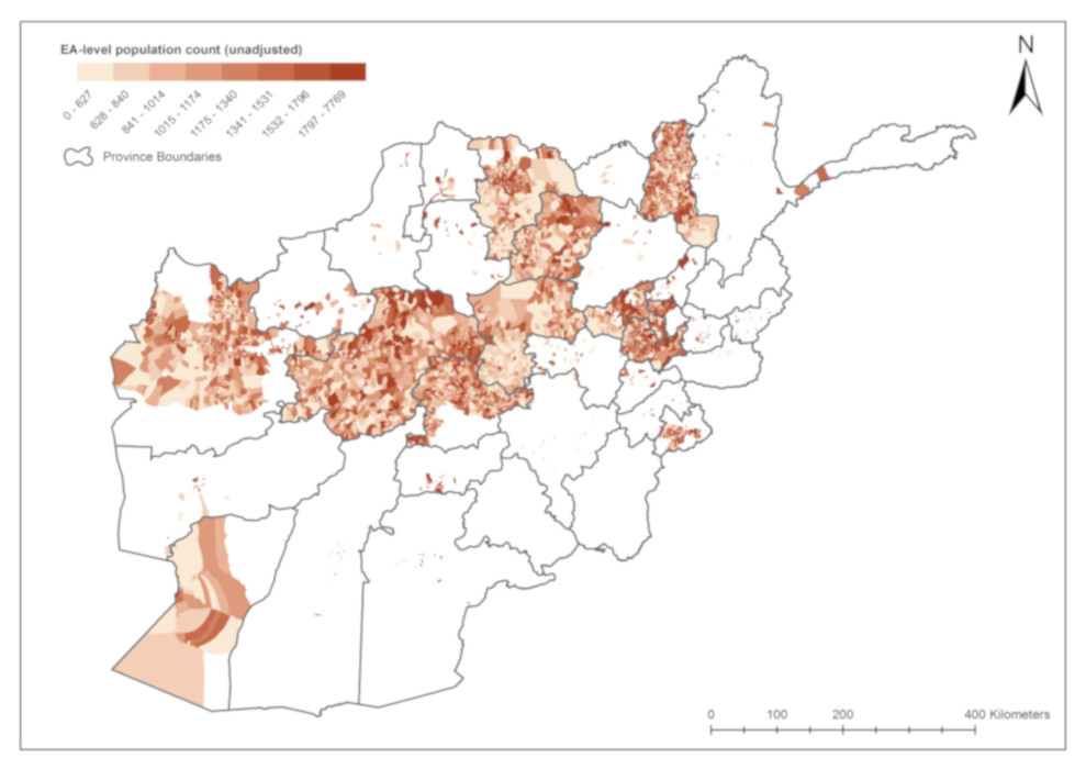
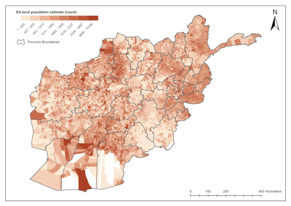
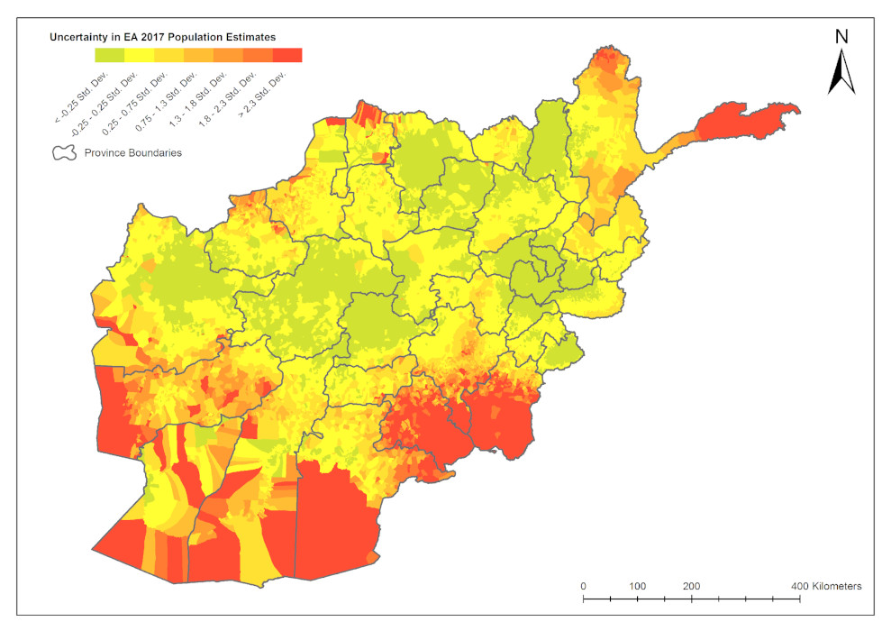
(left) Recently collected data on population numbers in Afghanistan. (centre) Complete national estimates produced through modelling; (right) Uncertainty in modelled estimates. (Click to expand image)
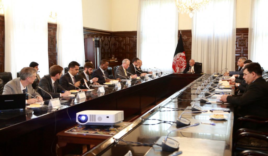
Professor Tatem (far left), head of WorldPop, presents the population mapping work to President Ghani and heads of government at the Presidential Palace, Kabul, Afghanistan.