
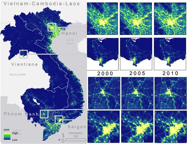
Tracking spatiotemporal changes in GHG emissions is key to successful implementation of the United Nations Framework Convention on Climate Change (UNFCCC). And while emission inventories often provide a robust tool to track emission trends at the country level, subnational emission estimates are often not reported or reports vary in robustness as the estimates are often dependent on the spatial modeling approach and ancillary data used to disaggregate the emission inventories. Assessing the errors and uncertainties of the subnational emission estimates is fundamentally challenging due to the lack of physical measurements at the subnational level. To begin addressing the current performance of modeled gridded CO2 emissions, this study compares two common proxies used to disaggregate CO2 emission estimates. We use a known gridded CO2 model based on satellite-observed nighttime light (NTL) data (Open Source Data Inventory for Anthropogenic CO2, ODIAC) and a gridded population dataset driven by a set of ancillary geospatial data. We examine the association at multiple spatial scales of these two datasets for three countries in Southeast Asia: Vietnam, Cambodia and Laos and characterize the spatiotemporal similarities and differences for 2000, 2005, and 2010. We specifically highlight areas of potential uncertainty in the ODIAC model, which relies on the single use of NTL data for disaggregation of the non-point emissions estimates. Results show, over time, how a NTL-based emissions disaggregation tends to concentrate CO2 estimates in different ways than population-based estimates at the subnational level. We discuss important considerations in the disconnect between the two modeled datasets and argue that the spatial differences between data products can be useful to identify areas affected by the errors and uncertainties associated with the NTL-based downscaling in a region with uneven urbanization rates.
Read more here: https://iopscience.iop.org/article/10.1088/2515-7620/ab3d91